When It Comes to Lake Levels, The Sponge Effect Strikes Again!
When It Comes to Lake Levels, The Sponge Effect Strikes Again!
By Clyde Morris, Director
Published June 3rd 2026
 If you’re wondering why Lanier’s water level hasn’t risen more due to recent rainfall, here’s a quick primer.
Lanier was at 1064.34 at the beginning of 2026. From then until the end of April, Gainesville’s reported rainfall was about 10” below average. May rainfall, about 6.4”, exceeded the average historical monthly amount by about 2”. That means cumulative rainfall is currently still about 8” below normal for the year, but we made up 20% of the deficit with May’s rains.
The lake level at the time of this writing is 1066.69, so the lake has risen 2.35 feet so far this year. Between April 30 and May 30, the lake rose from 1065.85 to 1066. 67, a rise of 0.82 foot or 9.84 inches – more than twice as much per month than in the first four months of the year. When you compare the lake’s rise to May’s rainfall, that’s a ratio of 1.54 inches of elevation per inch of rain, which is consistent with the ground becoming more saturated.
Those who think the lake should have risen more because of the rain in May probably have not adequately taken into account how dry the ground was to begin the month. When the ground is saturated, much more rainfall becomes runoff, Chattahoochee and Chestatee inflows spike, and lake levels rise rapidly. But when the ground is dry, a large portion of any rainfall disappears into groundwater recharge. Essentially, the ground acts like a sponge, holding the water rather than allowing it to enter the lake as runoff.
The U.S. Geological Survey and the Gwinnett County Department of Water Resources performed a highly detailed study of rainfall and runoff for that county from 2002 to 2020[i], and calculated that only 43.6% of rainfall became stream runoff. Given that Gwinnett probably has a higher percentage of impervious surface than the area surrounding Lanier, a runoff ratio of less than 44% would be predictable for Lanier. But the ratio changes significantly when the ground is either very dry or saturated.
For the conspiracy-minded among us who may suspect that the Corps was letting out too much water during May, let’s examine some data about Corps operations. According to the Corps’ daily data logs, Lanier’s daily inflows May 1 – 30 (May 31 had not been reported as of this writing) averaged 1468.03 cfs, while discharges from Buford Dam averaged 958.83 cfs, a difference of 509.2 cfs. Minimum flows measured near Peachtree Creek’s confluence with the Chattahoochee are required to average a minimum of 650 cfs for downstream water quality purposes. Allowing for evapotranspiration and downstream withdrawals for water supply, an average daily discharge of 958 cfs strongly suggests that the Corps was releasing only as much water from the dam as it was required to, which is consistent with what the Corps has claimed regarding its operations.
As for whether the Corps’ data accounts accurately for the lake’s rise in May, the volume of water that would accumulate in the lake when there is an excess of 509.2 cfs per day over 30 days (30,300 acre-feet) equates to right at the 0.82 foot of elevation rise that we witnessed (I say “right at” because we don’t know exactly how many acres Lanier’s surface covered at any given point in time during the month, which precludes more precise calculations).
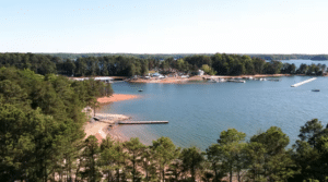
Now that the ground is much wetter than it was at the end of April, rains in the near future will probably contribute a higher percentage of runoff than we had earlier in the year. If the ground doesn’t dry out again, we may even see the unusual phenomenon of the lake actually rising after June 1. But either way, the lake is still down more than four feet from full pool, so keep a sharp lookout for underwater obstacles when you’re boating!
Article Sources: